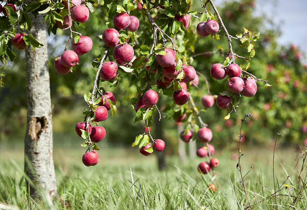
Irrigation strategy in apple orchards
Experience
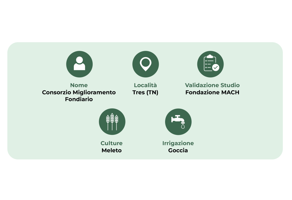
The Tres Land Improvement Consortium, in agreement with MACH foundation, during the 2022 season collected soil moisture data on a large scale, in depth and in real time using two probes to CRNS of Finapp, Using cosmic rays to assess the water content in the soil. A hill side cultivated with apple trees, with drip irrigation was monitored.
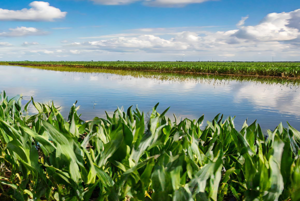
The consortium manages the irrigation of the crop (apple orchard) mainly operating with drip plants. The irrigation management of the valley is divided into sectors according to the slope and the exposure to the sun. Trentino, together with Alto Adige, are among the areas most affected by drought in the North-East. The purpose of this installation is to provide the Consortium and its members with relevant information to define the irrigation strategy according to the real water consumption, To optimize the apple orchard’s growth by evaluating the soil moisture behavior. The hilly, very stony terrain has always made it difficult and unreliable to measure soil moisture with traditional probes, such as TDR or similar and therefore we wanted to make field activities more reliable, simple and functional.
It is also intended to evaluate any differences between measurements obtained at a distance of several kilometres from each other in order to understand how homogeneous the water need is.
Use
Soil moisture assessment is one of the pillars on which to build an adequate irrigation strategy. This measurement is currently obtained by point sensors or satellite measurements. Both of these approaches have technological limitations, which is why irrigation is often based on the experience of professionals rather than actual measurements.
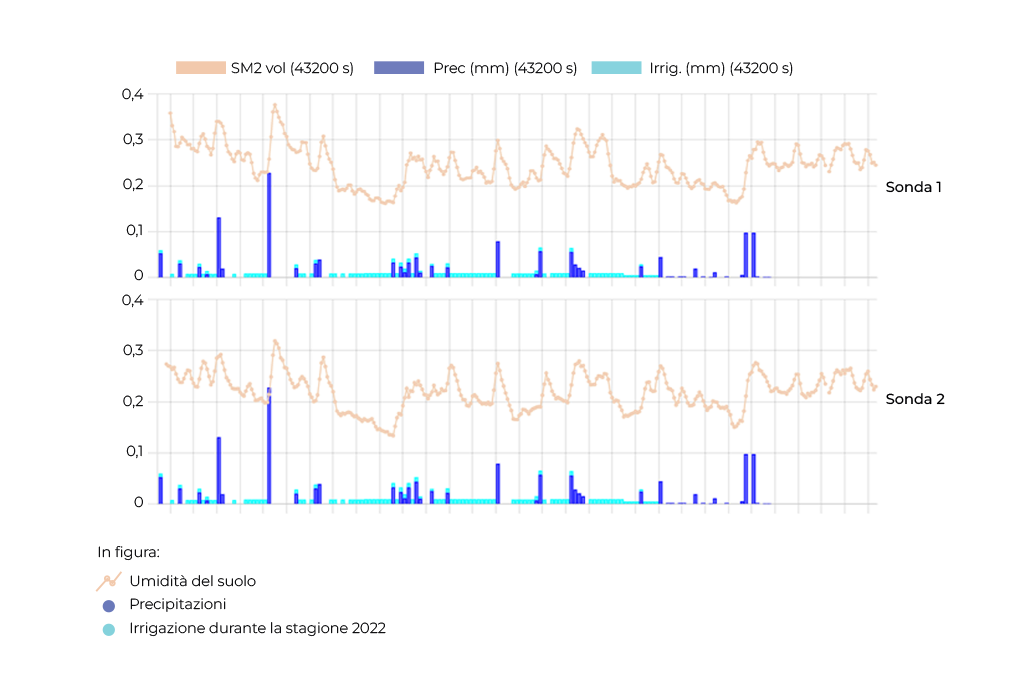
During the 2022 season, which was characterised by exceptional water stress, Finapp probes monitored two apple orchards in Trentino, some kilometres apart.
The rainfall between late May and early June (blue histogram), supported by a drip irrigation (blue histogram), allowed to keep the soil humidity within the optimal range, that is between the field capacity (gravimetric humidity of about 33%) and the point of withering (gravimetric humidity close to 15%).
In July, the almost total absence of precipitation, combined with strong sunshine and very above average temperatures, brought humidity to values close to the point of withering.
Irrigation was not sufficient to compensate for the evapotranspiration and only the return of rains in August, allowed the restoration of optimal conditions, with a more than satisfactory harvest. The test demonstrated the efficiency of CRNS probes compared to point probe limits.
Another information obtained was that concerning the homogeneity of the soil.
The correlation between the results obtained by the two probes in the two different plots showed a very similar trend of water in the soil, although two different areas were monitored and only a few kilometres apart.
This result is not surprising, since the soil moisture measurement of the Finapp probe, representative on ten hectares at high elevations, is able to overcome point dishomogeneity of the soil, Covering an area large enough to be representative of the whole area.
It is therefore possible to monitor soil moisture on large areas, even with a small number of probes, allowing the manager to make water available when and where needed.
Evaluating the irrigation segments, it was shown that with 6 or 7 CRNS Finapp sensors one would obtain soil moisture data of the whole valley, allowing ideal irrigation management from the side of the Consortium.
The test also revealed the limitations of traditional soil probes (such as TDR), in rocky and mountainous terrain, where measuring soil moisture with conventional probes is complex and unreliable.
Benfits
• Continuous quantitative (kg/kg) and/or volumetric (m3/m3) measurement.
• Large area monitored, even a whole slope. Spatial scale covering large medium areas, 5/20 ha.
• Non-invasive and non-contact measurements.
• Insensitivity to soil salinity, apparent density, texture and surface roughness.
• Indicates when is the best time to irrigate crops according to agronomic and operational parameters
• Optimise water resources by allowing irrigation in the right place at the right time and saving water
• Reduces product losses
• Reduces water and energy consumption by avoiding waste